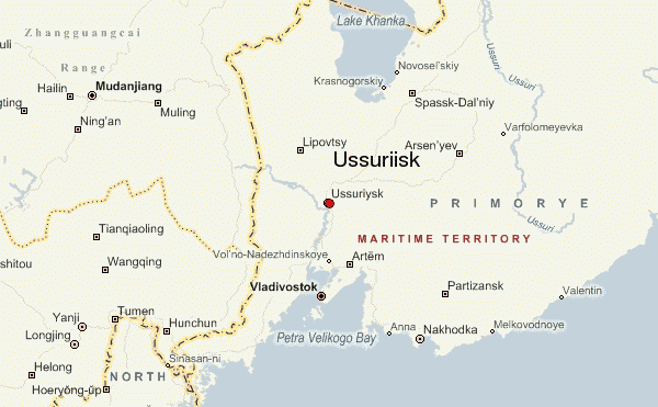
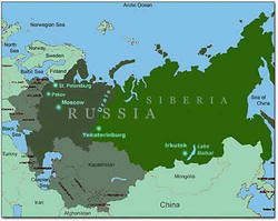
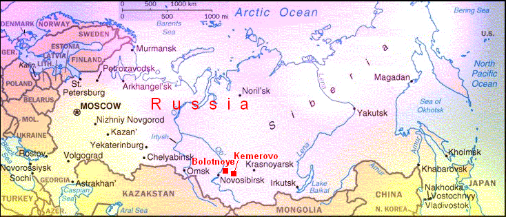
Where in the World is Vladivostok?

Everything in the Salmon color is Sister Blonquist's mission
Profile
|
The Russia Vladivostok Mission is geographically the largest mission in the world. It spans from Irkutsk in Siberia to Sakhalin, an island on the east coast. The largest church in Russia is the Russian Orthodox Church, which claims about 40% of the population. Another 40% does not practice religion. Several other religions are also present, with certain southern regions having majority populations of Muslims or Buddhists. Currently there are 60 missionaries serving in this mission, 12 of which are sister missionaries.
The branches are all relatively new, approximately ranging from about 5-15 years old. Currently, Ulan-Ude and Sakhalin are the only cities with their own church buildings. The other branches meet in a rented space. The branches range in size from having as little as five active members to one hundred active members.
|
Links of interest
|
“Behold, the days come, saith the Lord, that they shall no more say, The Lord liveth, which brought up the children of Israel out of the land of Egypt;
“But, The Lord liveth, which brought up and which led the seed of the house of Israel out of the north country, and from all countries whither I had driven them; and they shall dwell in their own land.” (Jer. 23:7–8.) "The ice shall flow down at their presence. And an highway shall be cast up in the midst of the great deep." (D&C 133:26–33.) "Behold, and lo, I have much people in this place, in the regions round about; and an effectual door shall be opened in the regions round about in this eastern land." (D&C 100:3) |
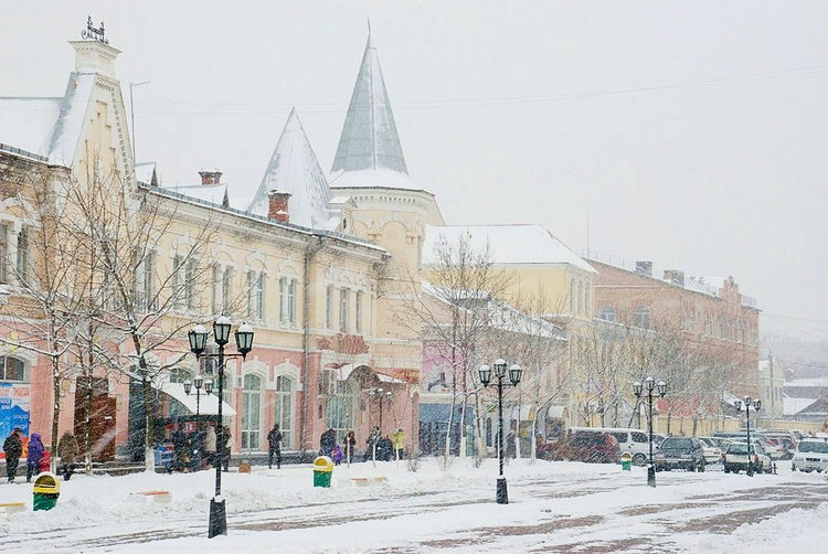
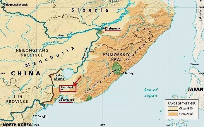
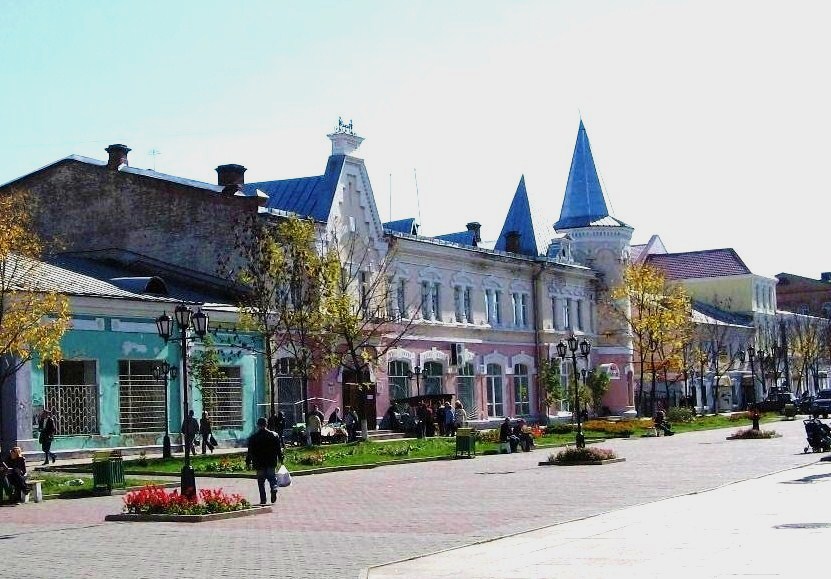
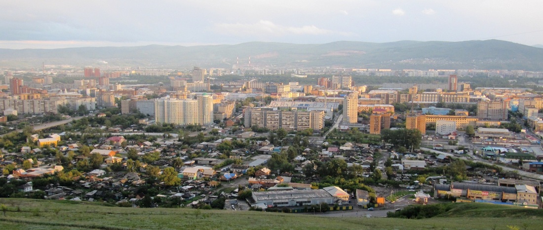
Area One: Ussuriysk - August 3rd to December 9th, 2016
|
|
The area of what now is Ussuriysk was settled by Yulou Mohe tribes. From the mid-9th century, it became Huàzhōu of the Bohai Kingdom. It is then populated by the Dōnghǎi Jurchens, under control of Liao dynasty. The city then become capital of Jīn Dynasty's Sùpín circuit. Then it went under control of Yuan, Ming and Qing dynasties respectively.
Modern eraMain article: Green UkraineIn 1866, the settlement of Nikolskoye (Нико́льское) was founded on the area of today's Ussuriysk, named after Saint Nicholas.[citation needed] Due to its advantageous geographic location at the crossing of the transportation lines, the village experienced rapid growth during the 1870s, turning into a trade center. Its role increased after the railroad connecting Khabarovsk and Vladivostok (now a part of the Trans-Siberian Railway) was built, and in 1898 it was granted town status and renamed Nikolsk-Ussuriysky (Нико́льск-Уссури́йский).
By the beginning of the 20th century the town's population totaled 15,000 people, and the annual turnover of its trade enterprises was equal to three million rubles. After the Russo-Japanese War of 1904-1905, Nikolsk-Ussuriysky became one of the most important commercial and economic centers of the Russian Far East. In 1913, the city ranked fourth after Vladivostok, Blagoveshchensk, and Khabarovsk in terms of population. Enterprises were established processing agricultural products such as mills, dairies, soap-boiling plants, and tanneries, as well as macaroni and sausage factories and breweries. Brick factories, quarries, and saw-mills were also built.
The central part of the city began to be built up with two- and three-story masonry buildings. In 1914, there were fourteen educational institutions, a theater, a circus, and three movie-theaters in Nikolsk-Ussuriysky.
After the October Revolution of 1917, the city's economy experienced rapid growth. The city specialized in processing agricultural products. The name of the city was changed to Voroshilov in 1935 after Kliment Voroshilov.[citation needed] With Nikita Khrushchev's ascent to power after Stalin's death the city's name was changed to Ussuriysk after the nearby Ussuri River in 1957.
Until the 1980s, the city ranked second in the krai in population, having only recently yielded to Nakhodka. Ussuriysk is still second only to Vladivostok as a theatrical and higher-educational center (it is home to the Pedagogical and Agricultural Institutes, and the Higher Military School).
Statistics Area 173 km2 (67 sq mi)
Population (2010 Census) 158,004 inhabitants - Rank in 2010 111th Population (2016 est.) 168,598 inhabitants Density 913/km2 (2,360/sq mi)[4] Time zone VLAT (UTC+10:00)
Founded 1866 City status since 1898 Previous names Nikolskoye (until 1898),
Nikolsk-Ussuriysky (until 1935),
Voroshilov (until 1957)
Official website
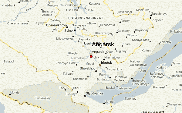
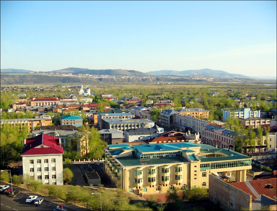
Area Two: Angarsk - December 9th, 2016 - May 22nd, 2017
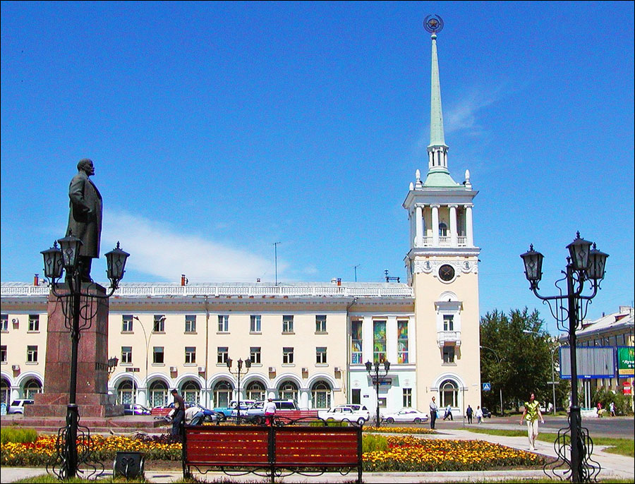
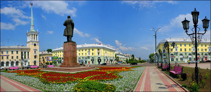
Angarsk, City Central
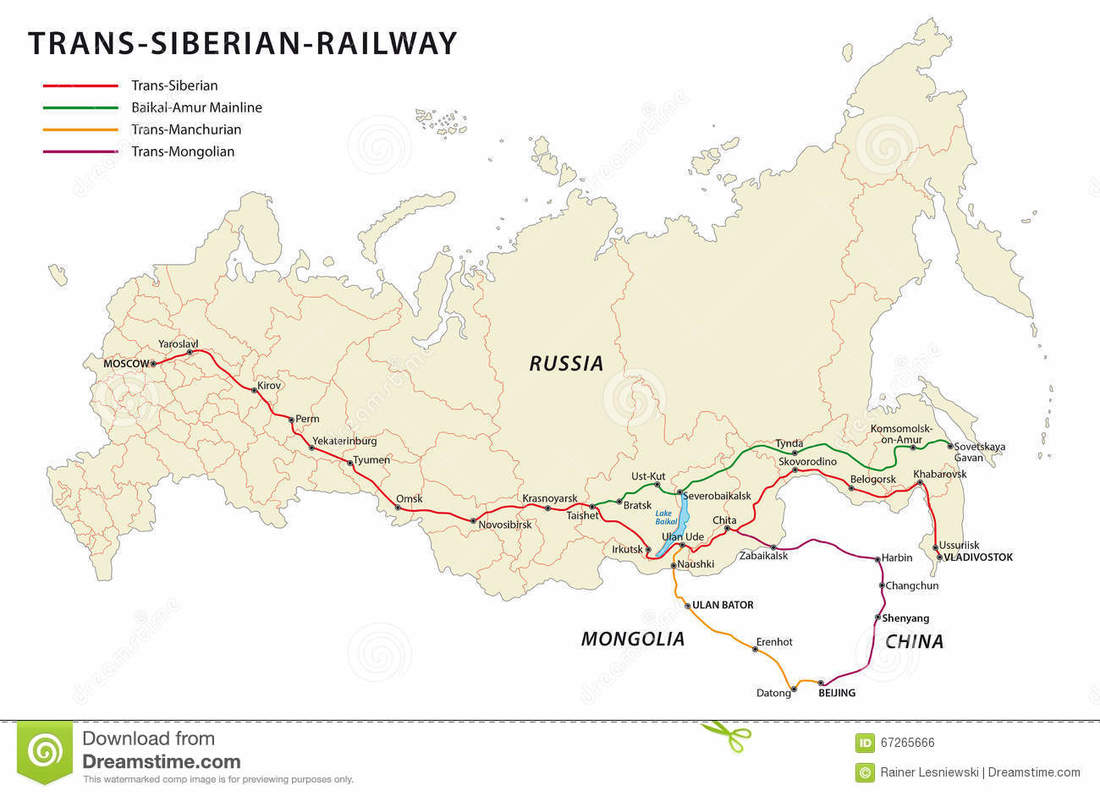
Angarsk is some 100 miles from the Mongolian boarder. Sister Blonquist will travel by the famous Siberian Railway from Angarsk to Mongolia for her visa renewal.
|
|
It was founded in 1948 as an industrial community and was granted city status on May 30, 1951
Administrative and municipal statusWithin the framework of administrative divisions, Angarsk serves as the administrative center of Angarsky District, to which it is directly subordinated. As a municipal division, the city of Angarsk and thirteen rural localities of Angarsky District are incorporated as Angarskoye Urban Okrug.
Local governmentAs a result of the elections of December 2, 2007, Leonid G. Mikhaylov was elected mayor. Previously, Yevgeny P. Kanukhin, elected on October 9, 2005, was mayor.
Economy
Angarsk railway station on the Trans-Siberian RailwayAngarsk has the largest industrial zone in Asia. It includes Angarsk Petrochemical Complex and Angarsk Electrolysis Chemical Complex. Angarsk also hosts a showcase international nuclear fuel cycle center, which will be one of the first Russian enrichment centers to be placed under IAEA safeguards. Angarsk is also the site for a Nuclear Fuel Bank, following a decision by the IAEA in November 2009; working with Russia, IAEA established this bank to supply market priced fuel to member states as protection against possible supply disruptions.
In 2005, Angarsk won the first prize in a nationwide contest for the fastest development of public utilities.
Transportation
KTM-19 tramThe city is connected by the Trans-Siberian Railway. Trams, buses, and marshrutkas (routed taxis) are the main means of public transportation in the city.
Culture and education
The city is home to the Angarsk Museum of Clocks and Watches, the Angarsk Museum of Victory, and the Angarsk State Technical Academy.
Statistics Population (2010 Census) 233,567 inhabitants
Time zone IRKT (UTC+08:00)
Founded 1948 City status since May 30, 1951
City Center
Angarsk
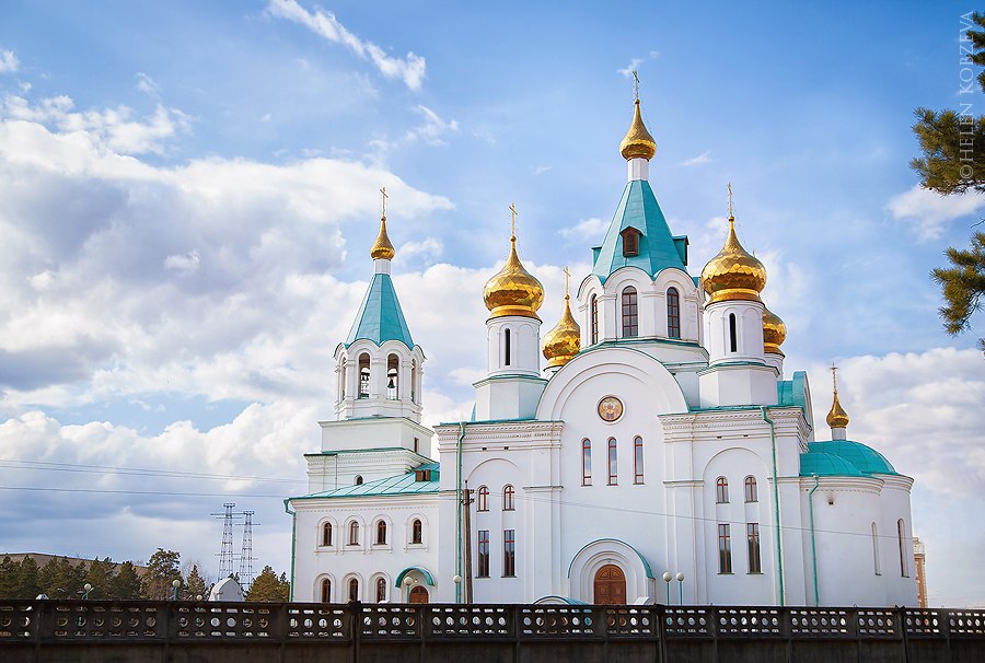
Holy Trinity Church
|
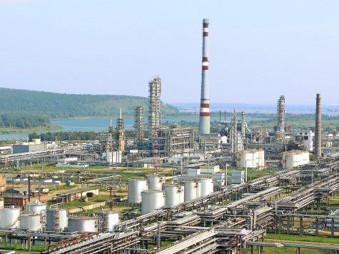
Angarsk oil refinery and on the left a city street in Angarsk
Sister Blonquist will now be serving on the western side of her mission. She will be about 2,500 miles away from Vladivostok, and President and SIster Perkinson. However, they visit often and Sister B will be surrounded by members and other volunteers who will help her learn all she can about her new area.
|
Angarsk Pass
|
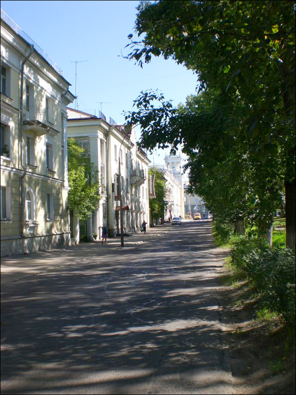
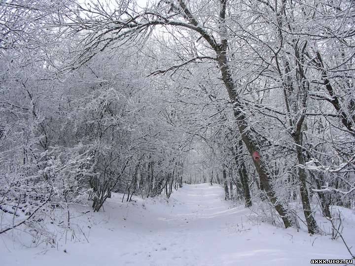
Angarsk. Winter Street
|
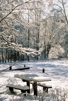
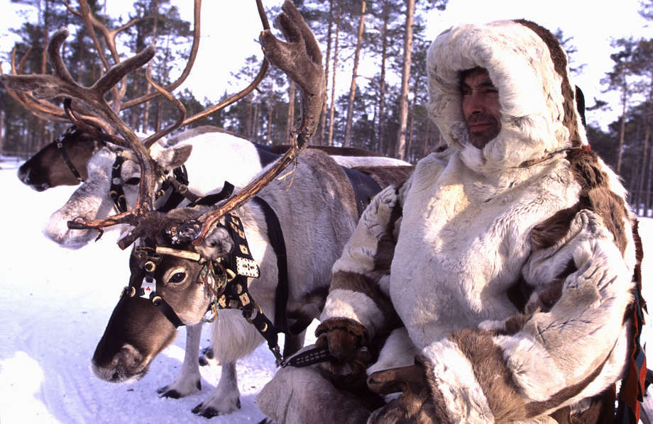
Perhaps some of you have seen this picture before. Yes, this is in Siberia, near the area where Sister B will be serving. In the cold. In the winter. Not unlike this. Hmmm...
|
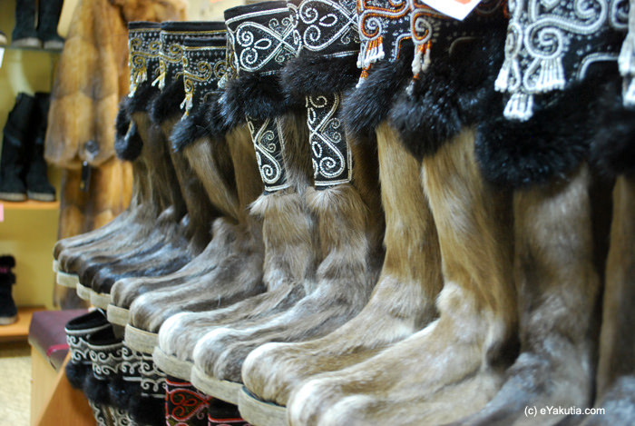
So as I post, it is currently -10 degrees in Angarsk. And it is only December. Sister Blonquist is probably going to need to pick up a pair of these from the reindeer people in Siberia. Reindeer fur boots. The warmest boots around. They are serious about their boots!
|
|
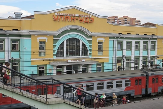
Area Three: Ulan Ude May 23, 2017 - August 13, 2017
|
|
Ulan-Ude was first called Udinskoye (У́динское) for its location on the Uda River. From around 1735, the settlement was called Udinsk (У́динск) and was granted town status under that name in 1775.[9] The name was changed to Verkhneudinsk, literally "Upper Udinsk" (Верхнеу́динск), in 1783 to differentiate it from Nizhneudinsk ("Lower Udinsk") lying on a different Uda River near Irkutsk which was granted town status that year.[9] The "upper" and "lower" refer to positions of the two cities relative to each other, not the location of the cities on their respective Uda rivers. Verkhneudinsk lies at the mouth of its Uda, i.e. the lower end, while Nizhneudinsk is along the middle stretch of its Uda. The current name was given to the city in 1934 and means "red Uda" in Buryat, reflecting the Soviet Union's Communist ideology.
Ulan-Ude lies 5,640 kilometers (3,500 mi) east of Moscow and 100 kilometers (62 mi) southeast of Lake Baikal. It is 600 meters (2,000 ft) above sea level at the foot of the Khamar-Daban and Khrebet Ulan-Burgasy mountain ranges, next to the confluence of the Selenga River and its tributary, the Uda, which divides the city.
Until 1991, Ulan-Ude was closed to foreigners. There are old merchants' mansions richly decorated with wood and stone carving in the historical center of Ulan-Ude, along the river banks which are exceptional examples of Russian classicism. The city has a large ethnographic museum which recalls the history of the peoples of the region.
|
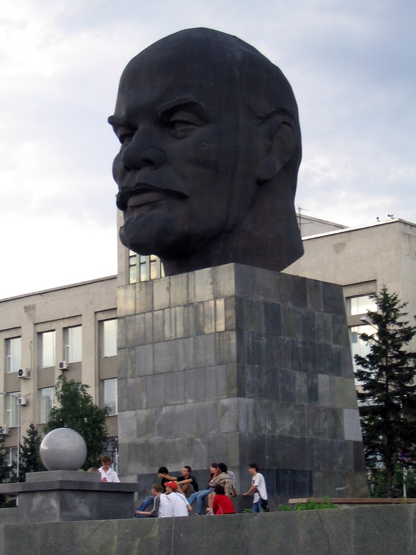
Pictured Left: There is a large and highly unusual statue of the head of Vladimir Lenin in the central square: the largest in the world. Built in 1970 for the centennial of Lenin's birth, it towers over the main plaza at 7.7 meters (25 ft) and weighs 42 tons.[14] The head has avoided the patina associated with bronze by a special coating and is a common meeting place.
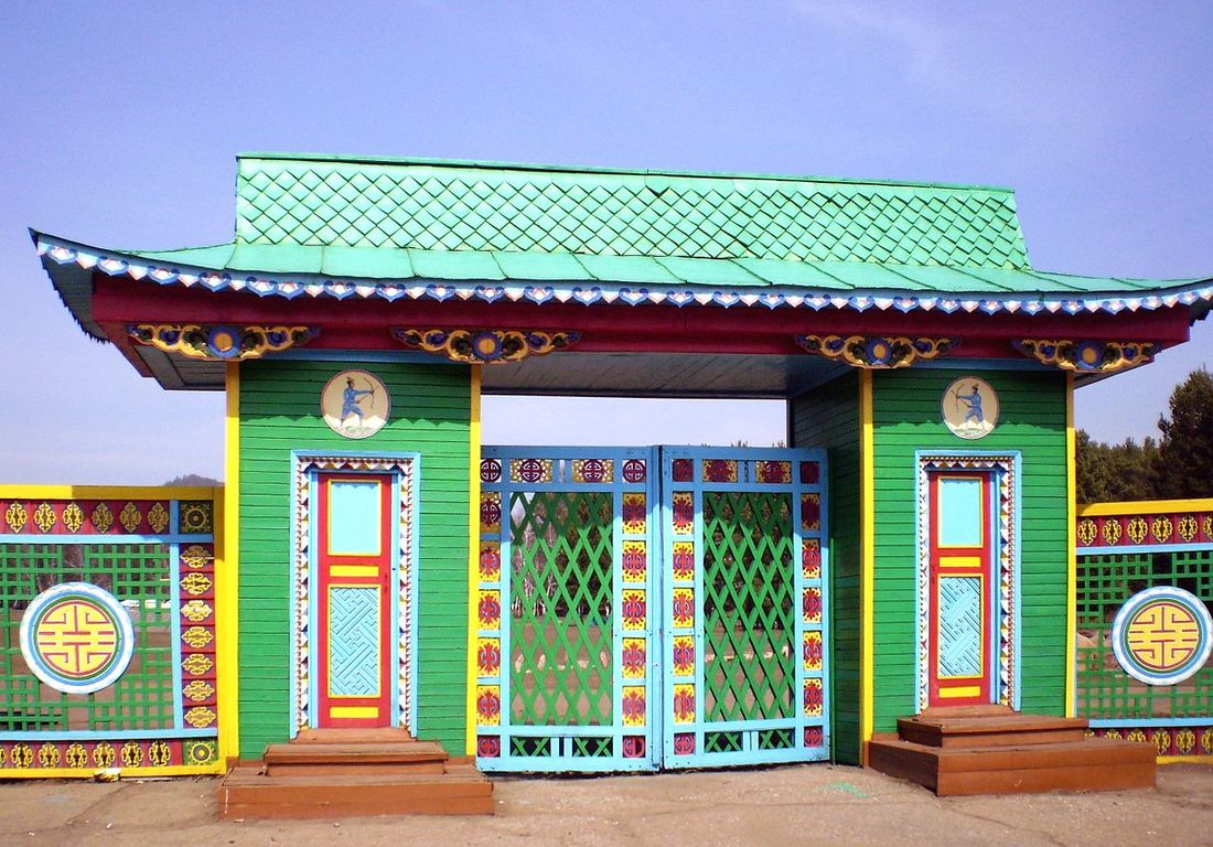
Pictured Below: Ethnographic Museum The museum opened on July 6, 1973 and is one of the largest open air museums in Russia, covering an area of 37 hectares. The museum has collected more than 40 architectural monuments and the museums collection exceeds 11,000 exhibits. One of the first pieces in the museum's collection was Nikolsk Church from the town of Nikolsk.
The territory of the museum is divided into seven complexes; the Archaeological Complex, which consists of a private pavilion and open area, the Evenkijskij complex, the Buryat Complex which consists of the gers (such as wood and felt), and Buddhist construction etc., the Cis-Baikal Complex, which contains a Buryat Cossack house, transferred to the museum in 1975, the Zabaikalsky complex which contains a barn and an old complex with peasant tools and barn.[1] About 400,000 people reside in Ulan Ude. The climate is long, dry, cold winters and short but very warm summers. Precipitation is low and heavily concentrated in the warmer months. |

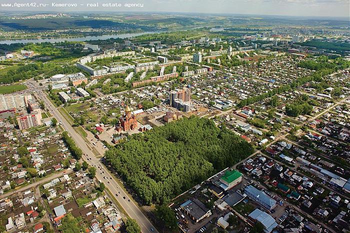
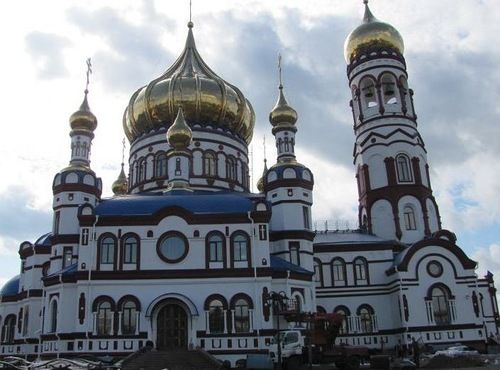
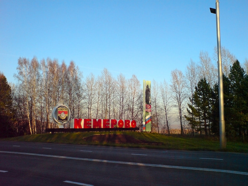
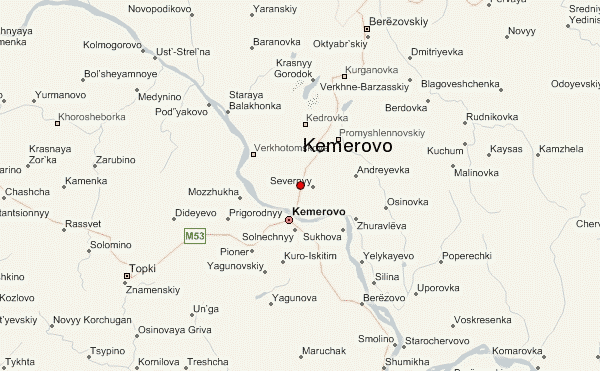
Area 4: Kemerovo August 14, 2017 to current
Kemerovo (in English)
Кемерово (Russian)
Кемерово (Russian)
|
Kemerovo (Russian: Кемерово; IPA: [ˈkʲemʲɪrəvə]) is an industrial city and the administrative center of Kemerovo Oblast, Russia, located at the confluence of the Iskitim and Tom Rivers, in the major coal mining region of the Kuznetsk Basin. Population: 532,981(2010 Census);[8] 484,754 (2002 Census);[13] 520,263 (1989 Census).[14]
Economy The industrialization of Kemerovo was driven and underpinned by coal mining and by the heavy industry based on the availability of coal. It remains an important industrial city, built up during the Soviet period, with important steel, aluminum and machinery based manufacturing plants along with chemical, fertilizer, and other manufacturing industries. Since the disintegration of the Soviet Union, the city's industries have experienced a severe decline, creating high levels of unemployment. Major companies based in the city include Siberian Business Union. |
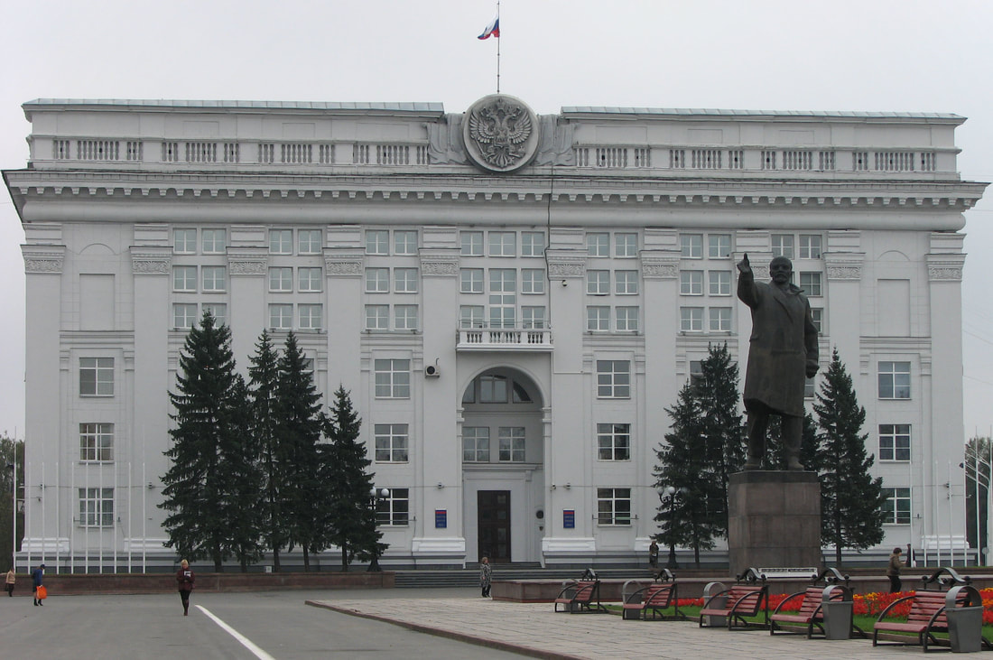
Sovetskaya Square in the center of Kemerovo
|
|
History
Kemerovo is an amalgamation of, and successor to, several older Russian settlements. A waypoint named Verkhotomsky ostrog was established nearby in 1657 on a road from Tomsk to Kuznetsk fortress. In 1701, the settlement of Shcheglovo was founded on the left bank of the Tom; soon it became a village. By 1859, seven villages existed where modern Kemerovo is now: Shcheglovka (or Ust-Iskitimskoye), Kemerovo (named in 1734), Yevseyevo, Krasny Yar, Kur-Iskitim (Pleshki), Davydovo (Ishanovo), and Borovaya. In 1721, coal was discovered in the area. The first coal mines were established in 1907, later a chemical plant was established in 1916. By 1917, the population of Shcheglovo had grown to around 4,000 people. The area's further development was boosted by the construction a railway between Yurga and Kolchugino (now Leninsk-Kuznetsky) with a connection between Topki and Shcheglovo. Shcheglovo was granted town status on May 9, 1918, which is now considered to be the date of Kemerovo's founding;[11] and was later known as Shcheglovsk. The town became the central location for the Kuzbass Autonomous Industrial Colony which was established there in 1921. 650 workers from 20 different countries settled there and set up what became the Kemerovo Coke Chemical Plant. Some of their descendants visited the modern factory in 2011.[15] On May 27, 1932, Shcheglovsk was renamed Kemerovo[11] and became the administrative center of Kemerovo Oblast in 1943. Kemerovo is twinned with: |
Education
Six higher education institutions are located in Kemerovo: Kemerovo State University, Kuzbass State Technical University, Kemerovo Institute of Food Industry (University), Kemerovo State Medical Academy, Kemerovo State Institute of Culture, Kemerovo Agricultural Institute and Kuzbass Economy and Justice Institute.
Sports
The public interest for bandy is widespread in Russia. 26,000 watched the opening game of the 2011-2012 Russian Bandy League when local club Kuzbass played against Dynamo Moscow[16] and Kuzbass is among the very best in the Russian Bandy League.[17] The 2007 Bandy World Championship was held in the city.[18] Female bandy only exists in a few places in Russia. Now Kemerovo is about to start it up.[19][20] Moscow already had two multi-use indoor arenas where bandy can be played. Kemerovo got the first one in Russia specifically built for bandy [6] (today also Khabarovsk and Ulyanovsk have it).[21] Kuzbass plays the matches in the league at Khimik Stadium because of the big public interest. That arena has a capacity of 32000.[22]
Since 2013 there has been a "bandy on boots" tournament for national diasporas living in Kuzbass.[23]
Climate
Kemerovo's position gives it a humid continental climate (Köppen Dfb) with average temperatures varying between −17 °C (1 °F) in January to +19 °C (66 °F) in July and relatively low precipitation of around 500 millimeters (20 in) annually.